Mappa ODINT Integralis Venezuelae
Un conjunto de datos geoespaciales integrado que cubre sitios de conflicto, instalaciones militares, rutas de tránsito fronterizo, infraestructura crítica, despliegues navales y ubicaciones humanitarias en toda Venezuela.
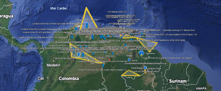
Vista general completa del conjunto de datos geoespaciales de Venezuela de ODINT
Este informe examina una colección de puntos y elementos geoespaciales que cubren Venezuela y algunas zonas adyacentes, según lo especificado en el conjunto de datos KML proporcionado. Los datos incluyen ubicaciones nominales que van desde ciudades y estados hasta instalaciones militares, activos petroleros, presuntos sitios de atrocidades y rutas de desplazamiento. Cada punto o polígono tiene un nombre asociado que suele sugerir su relevancia. Las zonas cubiertas abarcan el sureste de Venezuela, regiones amazónicas del sur, franjas fronterizas occidentales, el centro y norte del país, así como posiciones navales en el Caribe. Este análisis describe los lugares marcados y su posible relevancia estratégica y de derechos humanos.
Descargar el conjunto de datos KML
Abra el conjunto de datos geoespaciales completo en Google Earth, QGIS o cualquier aplicación compatible con KML.
Descargar Odint-venezuela.kmlResumen de puntos de datos
Estado Bolívar (Sureste)
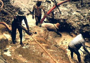
Varios marcadores aparecen en el estado Bolívar, en el sureste. Entre los nombres más relevantes figuran "Tumeremo", "Guasipati", "Mina El Cairo" y "Posible fosa Masacre Tumeremo". Estos puntos remiten a localidades y a un presunto sitio de fosa común cerca de Tumeremo. Las coordenadas se concentran alrededor de 7.3°N y 61-62°O. La zona es conocida por su actividad minera aurífera; la presencia de etiquetas como "Posible fosa Masacre" sugiere un sitio vinculado a denuncias de masacre en esa localidad. Las líneas etiquetadas como "Mina Actual a fosa coincide" conectan una mina con el lugar de entierro, lo que sugiere una superposición observada. También aparece un marcador del "Paraguana refining center", en la península de Paraguaná, uno de los principales nodos petroleros del país.
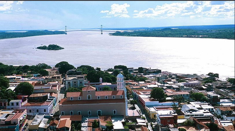
Marcas de posición del estado Bolívar: área de Tumeremo, sitios mineros y supuestas marcas de fosas comunes
Gran Sabana / Amazonas (Sur)
En el extremo sur, las coordenadas señalan "Kumarakapay", una localidad indígena cercana a la frontera con Brasil. Varias entidades sugieren rutas de movimiento: "Troncal-10 Kumarakapay / Brasil" traza una vía principal hacia Brasil, mientras que "Ruta de escape inicial Kumarakapay" indica un trayecto de fuga inicial. Un punto denominado "Asentamiento Posible Kumarakapay Escape Inicial" parece marcar un asentamiento o parada intermedia. También destaca el "Puente Rio Yuriani Primer Convoy" como cruce clave. Todo ello sugiere monitoreo de tránsito fronterizo y de asentamientos rurales en una región marcada por actividad armada y recursos minerales.
Gran Sabana / Amazonas: rutas de tránsito, vías de escape y cruces fronterizos hacia Brasil
Frontera occidental y región andina
Al oeste del Orinoco, los marcadores se concentran cerca de los 7°N y alrededor de los 70°O. Aparecen nombres como "Zona Brigada Caribes 92", "BRIGADA 92 CARIBES" y "Distancia brigada Caribes 92 con Colombia". Todo apunta al área de la Brigada 92 Caribes, próxima a la frontera colombo-venezolana. Una línea con esa misma etiqueta conecta el punto de la brigada con la frontera, subrayando su cercanía. En esa misma zona occidental también aparecen "Puesto de control La Victoria", "Yacimiento descontrolado" y "Zona Estacion de flujo PDVSA La Victoria", vinculados a control territorial e infraestructura energética en la franja fronteriza.
Región fronteriza occidental: Brigada 92 Caribes, estaciones petroleras y proximidad a Colombia
Caracas y región central
Un clúster denso entre 10 y 10.5°N y entre 66 y 67°O corresponde al área metropolitana de Caracas y estados cercanos. Entre los puntos clave figuran "Fuerte Tiuna", "Base Aerea La Carlota" y "Aeropuerto Charallave Oscar Zuloaga". También aparecen puntos etiquetados como "Strike 1, Strike 2, Strike 3", unidos por líneas de distancia que sugieren análisis de múltiples sitios de impacto.
Además se observan marcadores como "Maduro Bunker 1, 2, 3" y polígonos AOI asociados, ubicados en la periferia de Caracas a gran altitud, lo que sugiere búnkeres presidenciales o centros de mando. Otros puntos relevantes incluyen academias militares, "Masacre del Junquito" y "Carcel de Ramo Verde". Muchas líneas de la serie "distancia" parecen usarse para medir separaciones entre blancos, búnkeres y emplazamientos de interés.
Caracas y región central: sitios de ataque, búnkeres, cuarteles militares e infraestructura clave
Otra infraestructura
Los puntos y polígonos también indican instalaciones variadas. Entre ellas se encuentran "Subestacion electrica La Gran Caracas", "Aeropuerto Higuerote" con su polígono asociado AOI, "Puerto la Guaira strike" y la "Academia Militar Armada Bolivariana". En conjunto, estos marcadores reflejan infraestructura civil y militar de alto valor estratégico.
Zonas remotas / periféricas
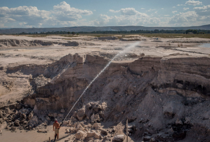
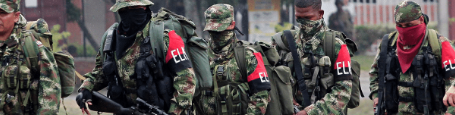
Los datos incluyen grandes polígonos etiquetados como “Los Soles OMA”, “Soles Oil”, “Soles Exportación Cocaína” y "Soles Frontier Operations". Cubren amplias zonas del sur de Venezuela y sugieren redes ilícitas o denominaciones operativas vinculadas con petróleo, narcotráfico y control territorial. También aparecen algunas coordenadas en Chile relacionadas con el caso Ojeda, probablemente incorporadas como material de contexto y no como parte central del mapa venezolano.

Zonas remotas y periféricas — Polígonos operativos de Los Soles que cubren el Arco Minero del Orinoco
Fuerzas navales (Caribe)
En una carpeta titulada "Despliegue Naval USA – Caribe – 3 Enero 2026" aparecen varios buques de la Armada estadounidense trazados en aguas del Caribe. Entre ellos figuran "USS Gerald R. Ford", "USS Winston S. Churchill", "USS Bainbridge", "USS Mahan", "USS Iwo Jima", "USS San Antonio", "USS Fort Lauderdale", "USS Lake Erie" y "USS Gettysburg". También se marcan "CARACAS – Objetivo Operacion" y "LA GUAIRA – Puerto Principal", lo que sugiere un marco hipotético de planificación operativa y vigilancia del despliegue militar extranjero.
Análisis e interpretaciones
De los datos cartografiados emergen varios temas centrales:
- Sitios de conflicto y posibles atrocidades masivas: la presencia de entradas como "Posible fosa Masacre Tumeremo", "Lugar de cuerpo de Ojeda" y "Toma Vicente Reyes Ojeda Body Found" apunta a posibles lugares de entierro, hallazgo de cuerpos o ejecuciones. Cartografiar estos sitios es esencial en clave de derechos humanos porque permite validar denuncias de masacres, ejecuciones extrajudiciales y desapariciones.
- Rutas de movimiento y control fronterizo: las líneas asociadas a rutas de escape, pasos y corredores permiten entender cómo grupos armados, traficantes o actores estatales podrían desplazarse entre Venezuela, Brasil y Colombia. Desde una perspectiva analítica, estos datos ayudan a seguir trayectorias de huida, contrabando y despliegue territorial.
Superposición analítica: rutas de movimiento, rutas de escape e infraestructura de control fronterizo
- Instalaciones de seguridad y militares: el conjunto destaca la infraestructura de seguridad venezolana. Puntos como "Fuerte Tiuna", "Brigada 92 Caribes", "Base Aerea Libertador" y "Academia Militar" identifican emplazamientos centrales del aparato militar. La concentración en Caracas sugiere foco directo en los centros de poder del régimen.
- Infraestructura crítica y activos petroleros: marcadores como "Paraguana refining center", "Zona Estacion de flujo PDVSA La Victoria" y "Subestacion electrica La Gran Caracas" señalan instalaciones energéticas de alto valor estratégico. En inteligencia, estas capas permiten cruzar seguridad, economía y posibles escenarios de sabotaje o interrupción operativa.

Mapeo de infraestructura crítica: refinerías de petróleo, subestaciones y objetivos de redes de energía
- Sitios civiles y preocupaciones humanitarias: la inclusión de aeropuertos, prisiones, centros poblados y puntos con posibles víctimas indica una capa de observación enfocada en impacto civil. Georreferenciar estos lugares permite contrastar daños, desplazamientos, evacuaciones y potenciales violaciones de derechos humanos.
- Presencia militar extranjera: la flotilla naval trazada frente a Venezuela, aunque externa al territorio nacional, tiene relevancia estratégica. Sugiere un marco de seguimiento de despliegue militar extranjero y posibles escenarios de intervención o coerción regional.
U.S. naval deployment positions — Caribbean carrier strike group, January 2026
- Cobertura geográfica: en conjunto, las coordenadas abarcan desde el Caribe hasta la Amazonía y desde Caracas hasta las franjas andinas y fronterizas. Esa amplitud sugiere un esfuerzo de vigilancia y documentación territorial de alcance nacional.
Relevancia estratégica y de derechos humanos
Cartografiar estas coordenadas tiene valor tanto estratégico como humanitario. Permite evaluar fortaleza estatal, vulnerabilidades, líneas de ataque, infraestructura sensible y posibles patrones de represión o violencia en función del terreno y la proximidad geográfica.
Desde la perspectiva de derechos humanos, el mapa respalda documentación, verificación y exigencia de rendición de cuentas. Cada sitio nombrado puede contrastarse con testimonios, fotografía, satélite y trabajo de campo, reduciendo zonas ciegas y fortaleciendo la cadena de evidencia.
Además, esta técnica de cartografía ayuda a verificar o refutar desinformación. Las coordenadas concretas eliminan ambigüedad y hacen más difícil ocultar hechos, movimientos o instalaciones vinculadas con violencia, represión o actividad ilícita.
"Conocer el terreno es acercarse a la verdad." La documentación geoespacial es, en sí misma, una forma de protección: disuade posibles abusos al aumentar la probabilidad de que los responsables puedan ser identificados por ubicación. En el trabajo de derechos humanos, contar con un mapa de inteligencia construido solo con puntos verificados mantiene el análisis anclado en evidencia comprobable y reduce la especulación más allá de lo que los datos cartografiados permiten sostener.
Conclusión
El mapa ODINT de Venezuela integra cientos de coordenadas y etiquetas que, en conjunto, dibujan el paisaje de conflicto, seguridad e impacto humanitario del país. Reúne zonas mineras, territorios indígenas, franjas fronterizas militarizadas, núcleos de poder en Caracas e infraestructura nacional.
Al cartografiar sistemáticamente cada sitio, este conjunto de datos ofrece base para análisis situacional, observación de patrones y nuevas líneas de investigación. En ese sentido, la cartografía geoespacial es una herramienta clave para documentar hechos y facilitar rendición de cuentas.
Explorar el conjunto de datos completo
Descargue el archivo KML y cárguelo en Google Earth o cualquier aplicación GIS para explorar todos los marcadores, polígonos y líneas de medición.
Descargar Odint-venezuela.kml